Bottom-Up Generation - Part 2: Geography
This is a procedure for generating the geography of a fantasy region. A follow-up from my previous post on what I’m calling “bottom-up generation”.
It divides a singlular realm into a number of swathes of terrain (called zones) and furth subdivides those zones into regions (15 to 18 in total) each ready for us to generate a location within that will be the base components of our setting.
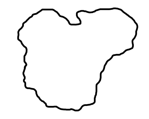
Step 1 - Draw a blobby, irregular shape on a piece of paper / some drawing program. This is your realm.
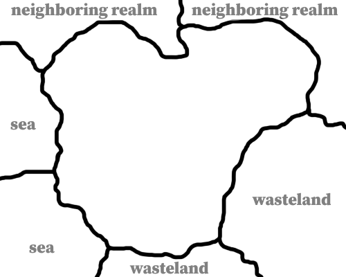
Step 2 - Divide the outside of the realm into 6 roughly equal sized and irregularly bordered border sections. Randomly select a border section with 1d6. Roll another d6, working clockwise, mark that many segments as sea. For each remaining land section, roll d6 - 1-3: neighboring realm, 4-6: wasteland.
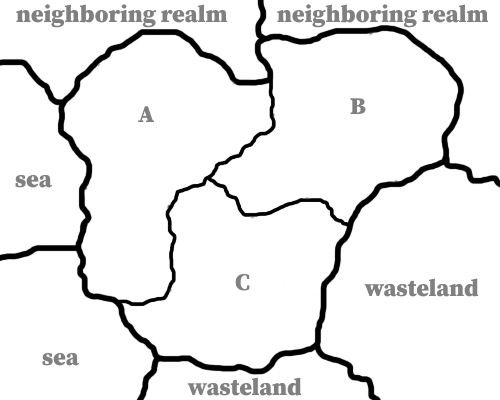
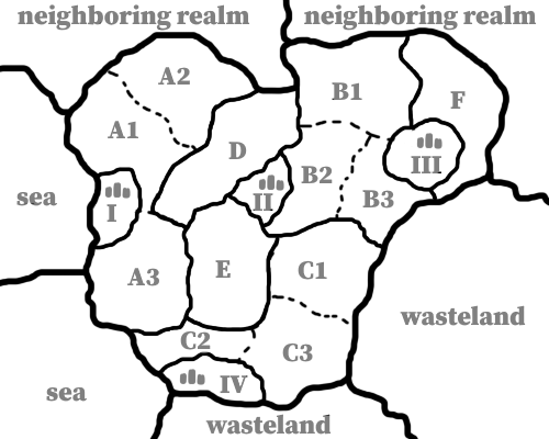
Step 3 - Divide the realm into 3 roughly equal sized and irregularly bordered Terrain Zones, and divide each of those zones into 4 Wilderness Regions each.
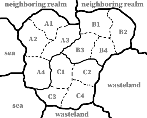
Step 4 - Roll d6 for each Zone, on a 1-3 add one City Region, 4-6 add two. Add City Regions by carving out small areas) about half the size of the already existing regions from the zone.
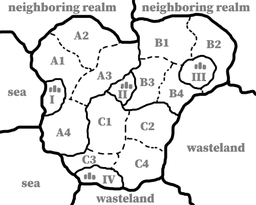
Step 5 – In each Zone, roll a d4 to choose a region randomly. This region splits off into its own mini zone with a single region in it. At this point you should have three Zones with 3 regions each and three zones with one region each, along with some city regions.
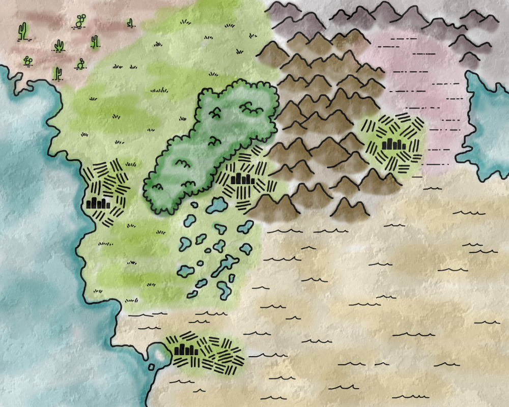
Step 6 - Generate terrain for each Zone. Use a random table or come up with your own. Keep it simple… A terrain type and an unusual detail is probably all you need at this point. Terrain in each of the city regions is farmland.
Roll twice on the following table and combine (wet+grassland=bog, forest+dry=thorn forest, etc).
Doubles indicate an exagerated type of that terrain (sweeping grasslands, towering mountains, etc.).
Weird means make it weird! (weird+forest=ghost trees, weird+wet=permanently foggy lands, etc.).
- Grassland
- Forest
- Mountains
- Wet
- Dry
- Weird
Generate two zone’s worth of terrain per bordering realm as well.
(this technique is snagged from this post from A Blasted Cratered Land’s blog.)
Here is what the map from above looks like with some terrain drawn on it
Step 7 - For each region, roll on the following table, this will give you a Major and Minor location within that region. Major locations we’ll give more detail to, and minor locations less detail. A Major Ruin might be a full-fledged dungeon, while a minor ruin might be a simple abandoned farmstead.
- Settlement with a minor Ruin
- Settlement with a minor Landmark
- Ruin with a minor Settlement
- Ruin with a minor Landmark
- Landmark with a minor Settlement
- Landmark with a minor Ruin
For city regions, roll d6 to determine only a minor location - the major location we know is the city.
1-2 Minor Settlement, 3-4 Minor Landmark, 5-6 Minor Ruin
Followup blog posts will go into generating and developing these locations, though there are many options for generating Landmarks, Settlements, and Ruins - Worlds Without Number, in particular, has some good tables for that purpose.